Stories Library
Stories

Uncovering the Ocean’s Secrets with Drones and 3D Technology
Drones and advanced cameras are powerful tools that help us understand our aquatic environments in ways that were previously impossible ...
KELPMAP – Upscaling drone-based maps using satellite images shows promise
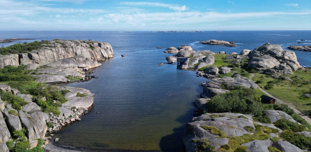
Helgelandskysten is one of Norway’s most beautiful coastlines, holding World Heritage Status (UNESCO) and ‘Outstanding Universal Value’. It has thousands ...
SeaBee shines at GeoHab 2024
SeaBee Research Infrastructure team members proudly presented at the international GeoHab Conference 2024 (6th – 10th May) in Arendal, Norway ...
SeaBee Out and About
The SeaBee experts have been busy, out and about sharing how SeaBee Research Infrastructure can be used, testing new possibilities ...
New SeaBee Pilots Ready to Fly
Preparations are well underway for the main field season in SeaBee for 2024. SeaBee Research Infrastructure relies on drone-based data ...
Nuts and Bolts of drone technology in SeaBee
The SeaBee Research Infrastructure relies on using state-of-the-art drones and sensors systems to collect data. Anders Gjørwad Hagen (NIVA) is ...
A few favourite things of SeaBee Research Infrastructure
SeaBee Research Infrastructure contains many different pieces that require coordination and expert input to run smoothly and deliver quality data ...
Trained to fly – Drone pilots in SeaBee Research Infrastructure
Drone pilots are a crucial part of the data collection for the SeaBee Research Infrastructure. We sat down with Tor ...
Annual Meeting 2023 – From outcomes to impact
All partners and industry partners met in Bergen for the SeaBee Annual Meeting (25 - 27th October, 2023) to update ...
Increasing flight range and monitoring capacity – Two New EVO Drones added to SeaBee family!
At last, a long-awaited, new arrival has come to SeaBee. SeaBee has received two new EVO drones. The new drones ...
Showing: 1- of 73