Stories Library
Stories

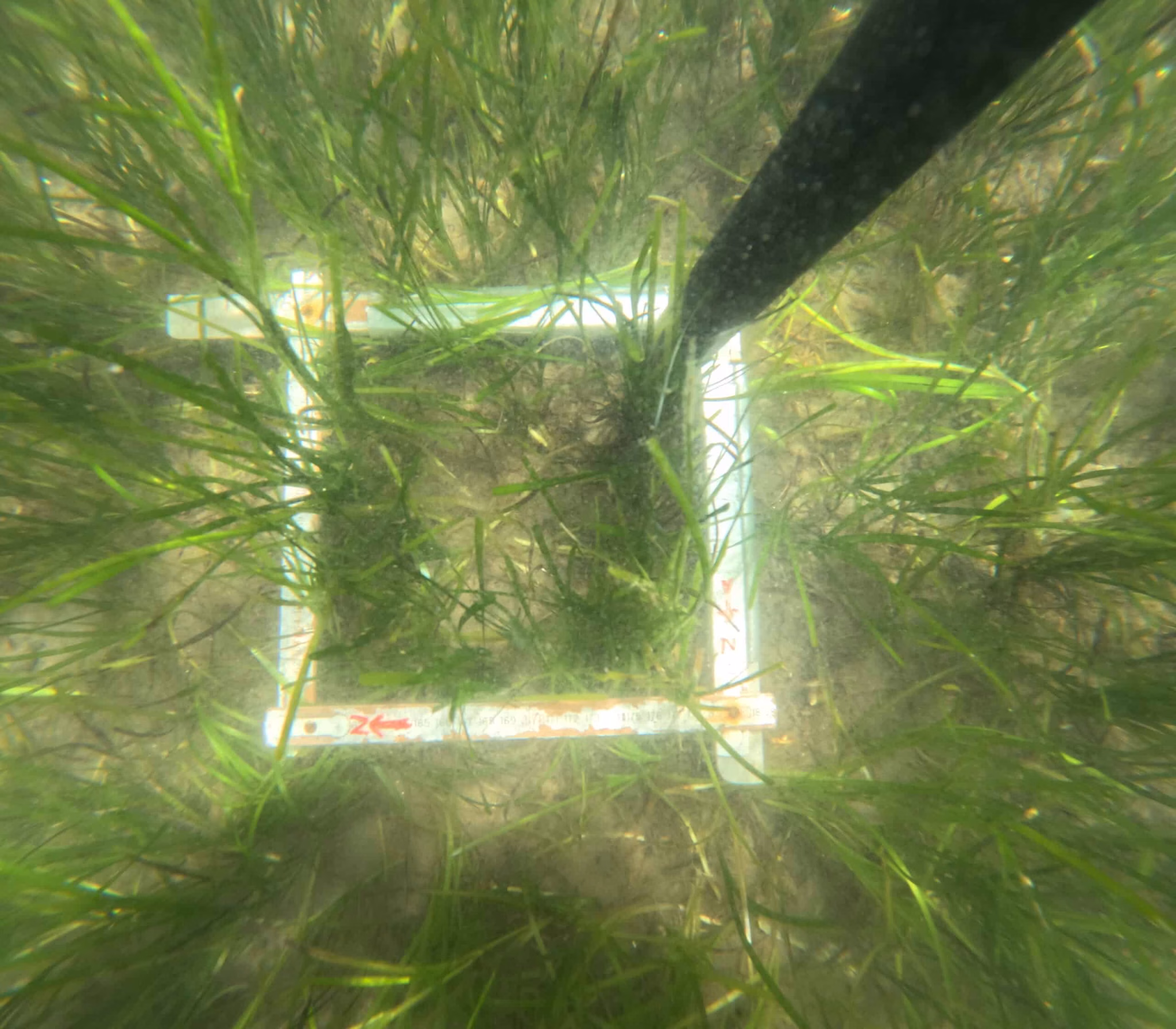
Using drones for mapping seagrass and coastal carbon inventories
SeaBee is being proven in the field through different applications and subprojects. ZosMap is a SeaBee subproject with focus on ...
Two weeks, 440 drone missions, 100 thousand images – The SeaBee Research Infrastructure is taking off!
SeaBee is creating a comprehensive national research infrastructure, enabling sharing and use of data, collected with drones, to better understand ...
SeaBee – The complete package
SeaBee and the Norwegian coast The Norwegian coastline is more than 100,000 km long. The coast is where people live ...
Mapping the Norwegian coast using Artificial Intelligence and drone images
Data Analysis in SeaBee Artificial Intelligence (AI) and machine learning are discussed widely – especially regarding the role as daily ...
Marine ecosystem mapping with drones and photogrammetry
Specialized drone pilots are using drone surveys to research coastal environments with aerial mapping to learn more about these ecosystems ...
SeaBee at GeoHab Conference
SeaBee experts attend this year’s international GeoHab conference (Marine Geological and Biological Habitat Mapping) at Réunion Island. They gave two ...
Sustainable and efficient research support
SeaBee at NIVA Sør´s 40th jubilee NIVA Sør celebrated recently its 40th jubilee. Several SeaBee experts attended, and among them Øyvind ...
Seeing Seals with SeaBee – exploring drone use in counting seals
How many coastal seals are there? Where are they along the coast? Which drone and sensor combinations are suitable for ...
SeaBee Data Platform – Satisfying sense of progress
The data storage and sharing component of the SeaBee infrastructure (the SeaBee Data Platform) is where we design and implement ...
New method using drones to investigate beach deposits
In January, members of the SeaBee team published a scientific article describing new methods on quantification of mass and carbon ...
Showing: 1- of 73