SeaBee Presents Blue Carbon Mapping at ESA Living Planet Symposium
Trygve Heide | June 25th, 2025 | Stories
At the 2025 ESA Living Planet Symposium in Vienna, SeaBee contributed to presenting its latest advances in blue carbon habitat mapping. Led by Kasper Hancke and partners from the C-BLUES project, the team demonstrated how drones, satellites, and AI are being combined to monitor seagrass ecosystems with high precision.
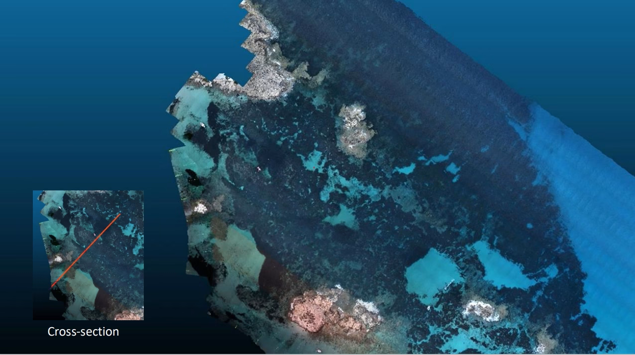
The presentation featured results from a field campaign in Formentera, Spain, where drones equipped with RGB, multispectral, and green LiDAR sensors mapped Posidonia oceanica reefs in 3D. One reef alone was estimated to store over 54 megagrams of organic carbon, equivalent to the emissions of a car driven for 45 years.

Map of Formentera

3D structure of Posidonia reefs
SeaBee also showed how drone data is used to train satellite-based models, enabling large-scale habitat classification. AI-powered tools generate detailed maps with confidence scores, supporting more accurate carbon stock assessments.

Uspcaling from Drone to Satellite
These tools will, in time, be openly available through the SeaBee GeoNode platform, helping researchers and policymakers scale up blue carbon monitoring across Europe.