SeaBee Showcases LiDAR-Based Coastal Carbon Mapping at OBAMA-NEXT Annual Meeting
Trygve Heide | January 29th, 2025 | Stories
At the OBAMA-NEXT annual meeting held in Naples on January 28, 2025, SeaBee coordinator Kasper Hancke presented new findings on mapping coastal vegetation, biomass, and carbon content using drone-mounted green LiDAR. The presentation, developed in collaboration with researchers from NIVA, IMEDEA, and SpectroFly, highlighted how this technology is advancing blue carbon monitoring and habitat classification.
Seagrass ecosystems such as Zostera marina and Posidonia oceanica are essential for climate regulation and biodiversity.

Figure 1: Seagrass Zostera Marina and Posidonia oceanica
They stabilize sediments, support marine life, and store significant amounts of carbon. Global estimates suggest that seagrass meadows hold between 400 and 900 megatonnes of carbon. Despite their importance, traditional mapping methods often lack the resolution and consistency needed for effective monitoring.
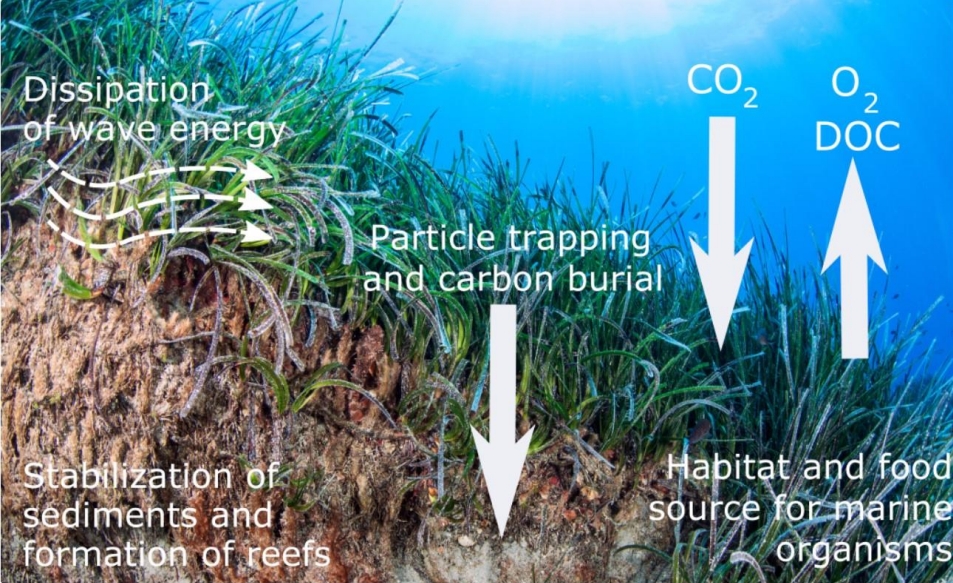
Figure 2: The importance of seagrass for CO2 uptake
SeaBee’s approach using newly available green LiDAR sensors mounted on drones to collect high-resolution 3D data of underwater habitats. Unlike red LiDAR, which is limited to terrestrial applications, green LiDAR can penetrate water and measure features such as canopy height, reef volume, and sediment accumulation in seagrass meadows. This capability makes it a powerful tool for assessing blue carbon stocks and management of blue carbon ecosystems.

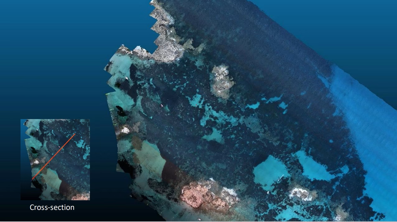
Figure 3: 3D Map created from LiDAR point cloud
One of the key case studies presented was from Els Pujols in Formentera. A single drone flight at 60 meters altitude collected over 50 million LiDAR points across 0.29 square kilometers. The data revealed a Posidonia reef with a volume of 2,301 cubic meters and an estimated organic carbon stock of 54 ± 5.6 megagrams. This amount of carbon is equivalent to the emissions of a car driven for 45 years or the body mass of approximately 4,000 tourists.

Figure 4: 3D model of the seafloor and Posidonia reefs
The presentation also demonstrated how SeaBee combines RGB and multispectral imaging with artificial intelligence to classify benthic habitats. Seasonal changes in the Oslofjord were mapped between May and September 2023, showing shifts in seagrass, macroalgae, and terrestrial vegetation. These classifications are generated using annotated drone imagery and machine learning models trained on ground-truth data.

Figure 5: Habitat mapping with drones: AI/ML classification
All data from the OBAMA-NEXT campaigns is available through the SeaBee GeoNode platform, which promotes transparency and collaboration across research communities.
Explore the data: https://geonode.seabee.sigma2.no