World Wetlands Day: SeaBee Helps Illuminate Norway’s Wetlands
Trygve Heide | February 2nd, 2026 | Stories
World Wetlands Day: SeaBee Helps Illuminate Norway’s Wetlands
Along the Norwegian shoreline, wetlands form a quiet but powerful foundation for coastal life. Salt marshes absorb storm surges, coastal meadows host diverse plant communities, and tidal mudflats feed seabirds and filter the water that moves between land and sea. These habitats are essential for biodiversity, climate regulation and coastal protection, yet they remain among the least understood parts of Norway’s coastal environment. Many municipalities still lack the spatial knowledge they need to protect these ecosystems, which face growing pressure from nutrient inputs, development and climate change.

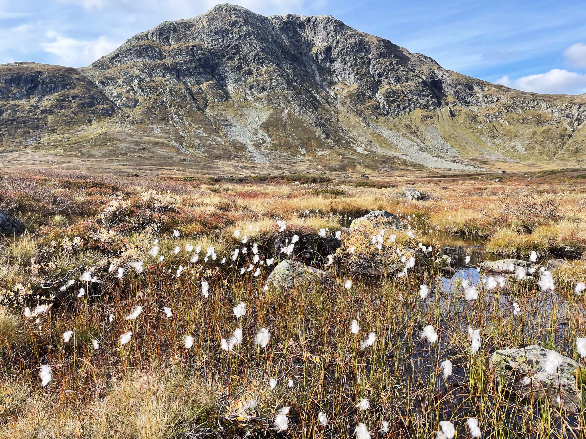
Figure 1: Fjortentjernsmyrene large mire/wetland plateau area located on Vardalsåsen. Photo credit: Ingvild Skumlien Furuseth / NIVA

Figure 2: Medyan flying the Matrice 350 in order to map the coastline with a Multispectral Camera. Photo Credit: Trygve Heide / NIVA.
EOCEAN uses SeaBee’s capabilities to map wetlands across the full land to sea interface. When SeaBee surveys a coastline, its drones capture ultra high resolution imagery that shows the textures and boundaries of salt marshes, the structure of coastal meadows and the exposed surfaces of tidal flats. These images, together with ground truth data and machine learning models, allow EOCEAN to map wetland habitats with unprecedented clarity. The project expands SeaBee’s existing habitat classifications to include these semi marine and terrestrial coastal ecosystems, ensuring that wetlands are represented as connected systems rather than isolated features.

Figure 3: Saltmarsh in Hvaler. Photo credit: Trine Bekkby / NIVA.
To support broad scale municipal planning, EOCEAN also links SeaBee’s local drone mapping with satellite based upscaling. This combination gives municipalities both detailed local insight and full coverage of their coastal areas. The resulting ecosystem extent accounts show not only where wetland habitats exist today but also how they are changing over time. With wetlands facing increasing stress, this perspective is essential for long term resilience and nature based management.
All EOCEAN maps and accounts will be made available through the SeaBee GeoNode platform, which ensures that municipalities can discover, view and download updated wetland data. This accessibility is a crucial part of the project. Without easy access to reliable information, wetlands remain invisible in planning processes. With it, local authorities can identify vulnerable areas, guide sustainable development and prioritise protection and restoration measures backed by evidence.

Figure 4: Screenshot from SeaBee GeoNode platform.
Wetlands do not ask for attention, yet they provide services that reach far beyond their boundaries. They stabilise coastlines, store carbon that helps moderate the climate and support a network of life that thrives in the narrow band between land and sea. On this World Wetlands Day, SeaBee is proud to help bring these ecosystems into clearer view. By combining advanced drone technology, high resolution mapping and open data, SeaBee and EOCEAN are creating a stronger foundation for understanding and safeguarding Norway’s coastal wetlands for the future.
Stories
YellowScan Explorer Strengthens SeaBee’s LiDAR Capacity
YellowScan Explorer Strengthens SeaBee’s LiDAR Capacity The YellowSc[...] Read more
Overview of the SeaBee Data Platform
SeaBee has officially released a comprehensive new report titled ̶[...] Read more
SeaBee at the MPA in MSP Conference in Bodø
SeaBee Showcases Cutting-Edge Drone and AI Tools for MPA Monitoring at[...] Read more