Joint Formentera Drone Mapping Campaign
svein | October 8th, 2024 | Stories
Written by Charlotte Synnøve Garmann-Johnsen

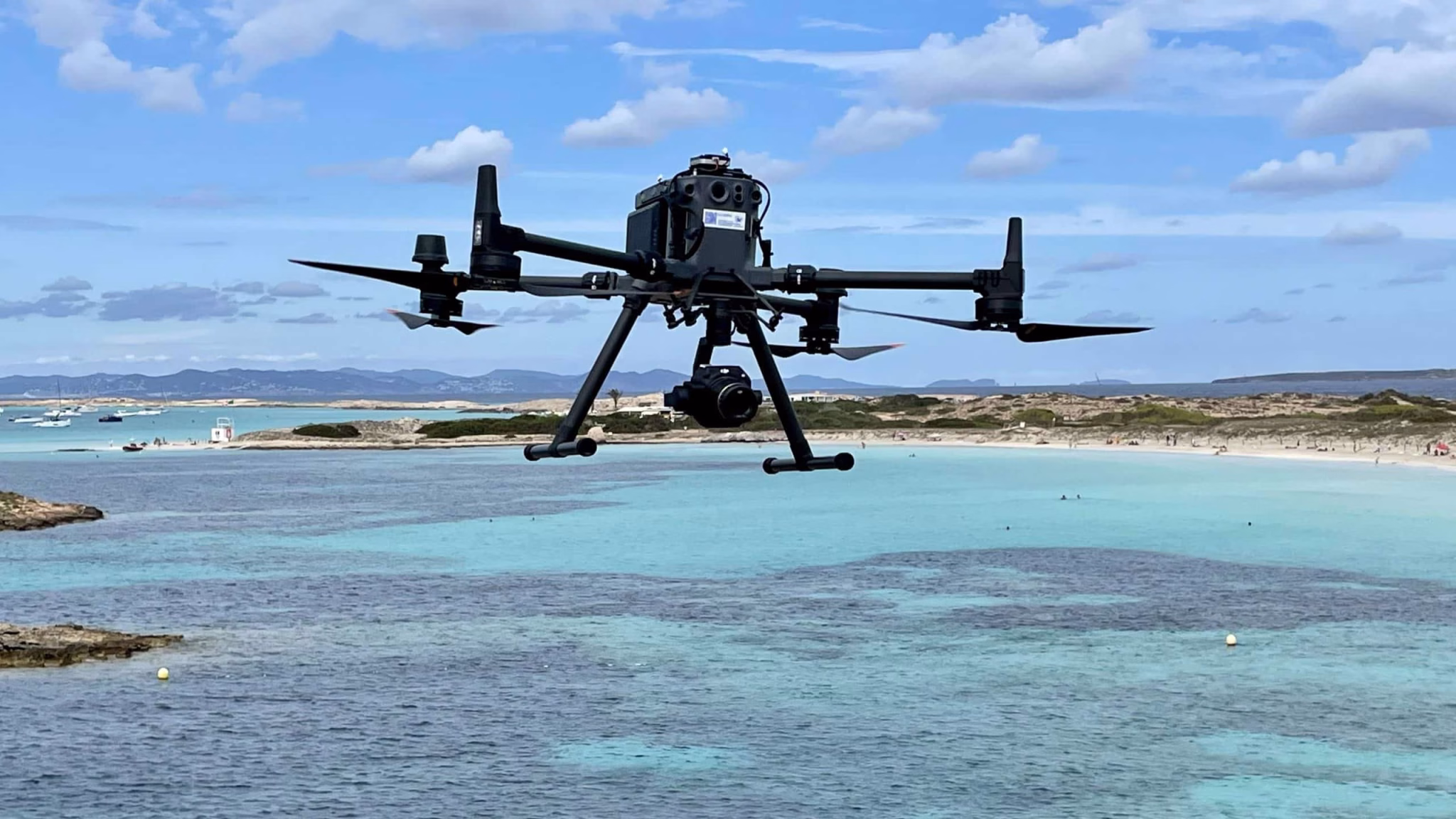
Take-off with green LIDAR sensors mounted on a drone for high resolution 3D scanning of seagrass meadows at Formentera in the Mediterranean. Drone-borne green LIDAR systems are brand new to research and perhaps this is the first time applied to seagrass research in Europe. The LIDAR system is a Navigator delivered to SeaBee by YellowScan in August 2024, mounted on a Tundra2 drone from Hexadrone. A powerful addition to SeaBees drone infrastructure.
An intensive field campaign was taking place in Formentera, Spain, from September the 16th to the 20th. This was a collaboration between SeaBee and two ongoing Horizon Europe projects, OBAMA-NEXT and C-BLUES, aimed at advancing our understanding of marine ecosystems.
For the first time in SeaBee, and perhaps for the first time in European marine research, a drone-borne green LIDAR sensor has been applied for mapping of submerged vegetation and seagrass meadows! Green LIDAR offers a completely new perspective to seagrass studies by allowing the generation of high-resolution 3D models of the meadows at centimeter-scale resolution. This again enables the creation of digital twin models, estimating seagrass canopy height, and compute biomass and carbon stock quantification.
Overall, the campaign focused on mapping and classifying marine blue carbon habitats including seagrass meadows and its ability to store carbon and promote biodiversity among other ecosystem services.
A multidisciplinary team including marine biologists, drone and satellite remote sensing specialist, and data analysts from NIVA, RBINS and IACM was working together to create a comprehensive understanding of these complex ecosystems and map their distribution.


Senior researcher and SeaBee coordinator Kasper Hancke measuring Ground Control Points (GCPs) at Formentera, for accurate positioning of drone and satellite orthomosaics
‘The main goal of this campaign was to develop and evaluate methodologies for mapping and monitoring seagrass and other submerged coastal vegetation. In particular, the focus was on integrating satellite and drone data using AI predictions intercalibrated from ground truth data’- Kasper Hancke.
To address this, RGB and multispectral image data from drones and satellite were collected, along with underwater ground truth data and ground control points for remote sensing data validation and referencing.

A drone ground control unit showing the drone mission status, and the images recorded by the drone, here a seagrass meadow and a coastal rock.


Drone pilot Robert N Poulsen and SeaBee coordinator Kasper Hancke planning a drone mapping mission (left) and a DJI M350 drone just before take-off on a mapping mission at Illetes, Formentera.
The images give us information about seagrass distribution, canopy height, carbon storage and other relevant factors for monitoring the seabed.

Take-off with a DJI M350 drone with a high resolution RGB camera onboard (DJI P1 camera). The same drone was also applied to fly multispectral missions with a five-channel Altum-PT sensor from MicaSense.