SeaBee drone infrastructure supports research project
Charlotte Garmann-Johnsen | March 22nd, 2022 | Stories
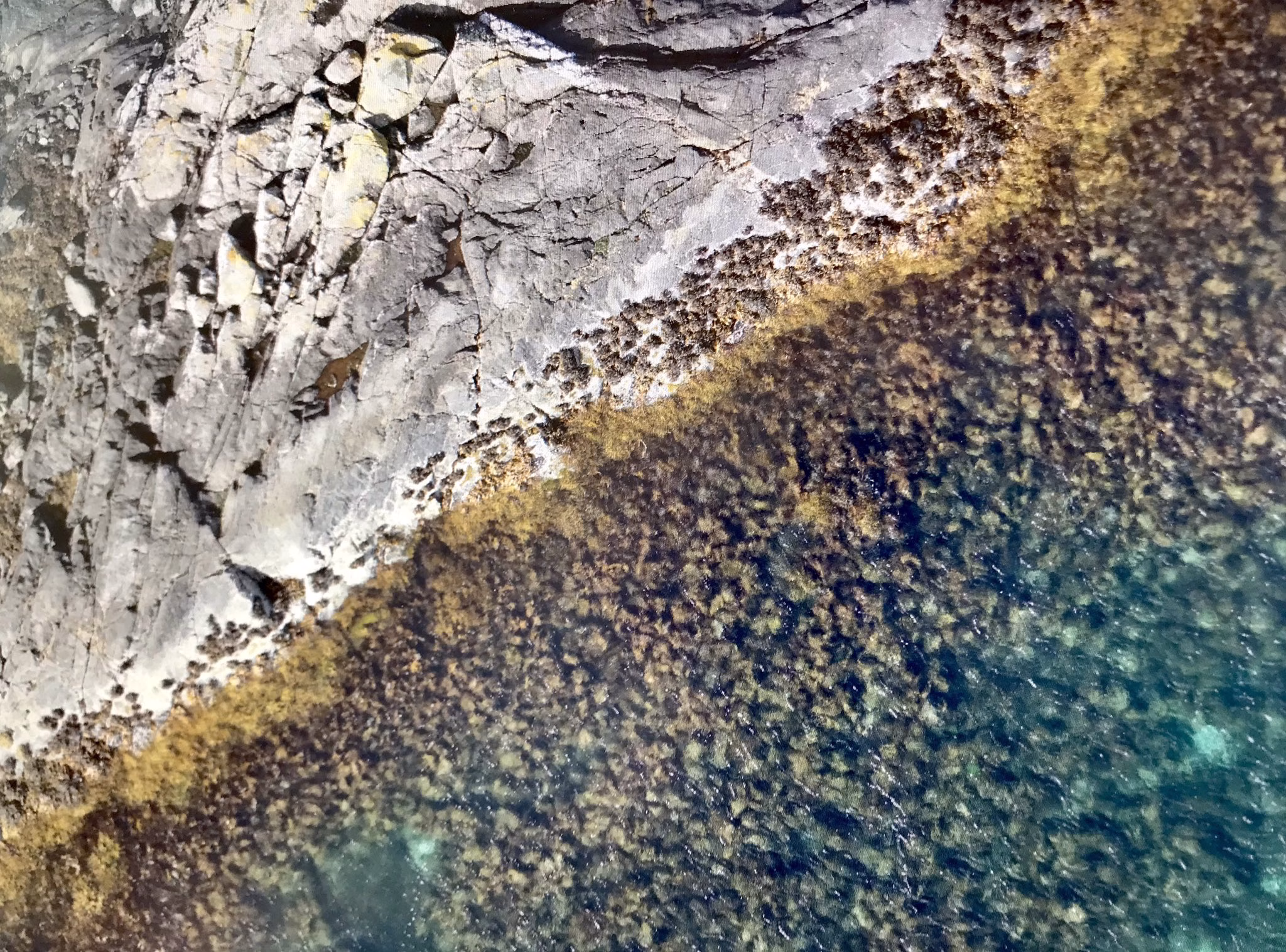
Last week, SeaBee’s drone infrastructure helped provide high-quality images of a study site for the COASTFRAG project. Thanks to SeaBee’s imaging capabilities and infrastructure, scientists working on COASTFRAG can calculate the fragmentation index from the images. The project’s other partners have also done the same, with areas studied in the United Kingdom, Estonia, and Spain.
COASTFRAG studies how habitat fragmentation, temperature, water quality, wave exposure and predation affect intertidal seaweed communities across Europe. The project will create models and projections into a changing future, and will increase our knowledge to better protect these essential ecosystems.
Trine Bekkby, who works on both COASTFRAG and SeaBee (WP5 Lead), was very happy with the results:
“We have now integrated the drone images into GIS and will start working with them. And, as you can see, this is much better that what we had before!”
