Seabird monitoring
Mapping seabirds quicker with higher accuracy and repeatability and lower disturbance.
Charlotte Garmann-Johnsen | October 14th, 2022 | Applications
In SeaBee, we develop methods to map seabird nests quickly, with low disturbance to the birds, and with higher accuracy and repeatability. This also enables us to count chicks in the colonies, resulting in breeding success data previously not available, and to map and count seabirds and ducks outside the breeding season.
SeaBee has revolutionized seabird colony counting in Norway. Using state-of-the-art drone technology, we now conduct large-scale, non-intrusive bird counts with higher accuracy and repeatability. Our AI-based pipeline enables quicker mapping and documentation of different species and their activities. In most cases, our autonomous drone-based approach drastically reduces human disturbance in the seabird colonies, by allowing us to monitor seabird colonies from a distance.
The methods developed in SeaBee are also relevant for monitoring seabirds around human infrastructure, such as offshore wind, and to monitor species that are not monitored in current programs, as common gull and terns.
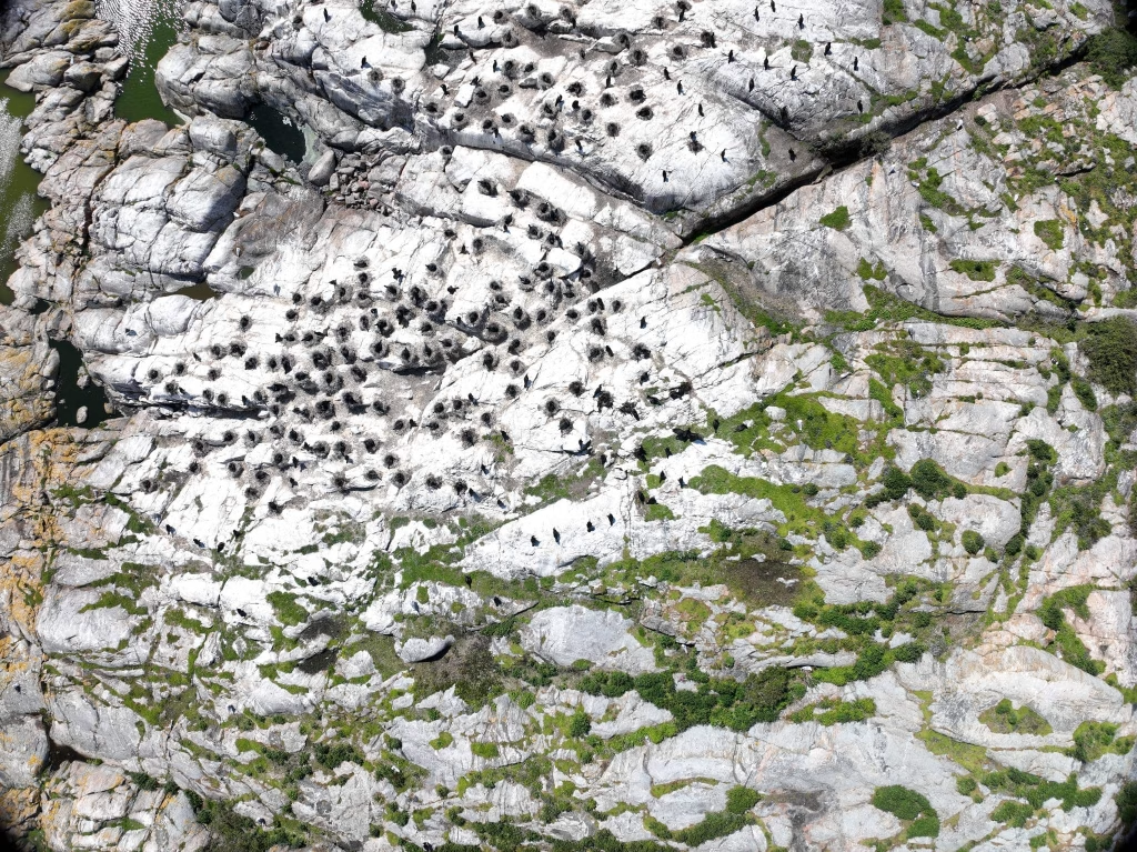
Drone image of seabird population, collected during NINA’s field work in May 2023. Photo: Sine Dagsdatter Hagestad
SeaBee Technology
To collect drone imagery of seabirds, we use a combination of multirotor drones, including DJI Mavic 3 Enterprise, DJI Mini 2 and DJI Matrice 300 RTK with P1 or H20T. The drones are flown in from outside the colonies, usually mapping the areas by flying over in a grid pattern. Images are then orthorectified and analyzed using a machine learning model trained for the purpose. All images collected are published at SeaBee’s GeoNode server. We have also tested heat-seeking infrared sensors for detecting chicks in the colonies with a higher degree of accuracy.
We have developed a database designed to store both annotations of individual birds and automatic detections. Data are then aggregated and sent to other databases automatically, including SeaBee’s GeoNode server. The database is the basis for data visualised on Seapop (nina.no).

Deployment of a Mavic 3 Multispectral from a boat near a seabird colony. Photo: Marie Curtet

Annotation results from bird-mapping at Runde, August 2022. The automated pipeline has identified the birds on nests and the bird flying, from the drone image. Image: Arnt-Børre Salberg

A colony of black-headed gulls at Tuskjær in Oslofjord, with many nests visible. Photo: Sindre Molværsmyr
Contact
Interested in learning more about our work marine mammals or opportunities for collaboration? Please contact us:
Leads of work on seabirds in SeaBee: Geir Systad and Sindre Molværsmyr from NINA
SeaBee operations coordinator: Trygve Heide (NIVA)
Examples of our work
STORIES

PUBLICATIONS