
Water quality
Assessing ocean colour and water quality using aerial drones.
Charlotte Garmann-Johnsen | October 18th, 2022 | Applications
Remote sensing with satellites is commonly used to assess water quality based on ocean colour, but it has limitations like cloud coverage and atmospheric light scattering. While effective in open ocean areas, coastal areas pose additional challenges due to the influence of land-derived matter and small-scale topographic features, requiring high-resolution images. SeaBee uses drones to collect data with higher spatial and temporal resolution than from satellites, developing ocean colour methods using hyper and multi spectral cameras on aerial drones. Our work on ocean colour includes:
- Adapting remote sensing methods for drones to assess concentrations of phytoplankton and mineral/organic material
- Contributing to improvements of remote sensing methods by using observations collected by drones
SeaBee Technology
Seabee’s multispectral (Micasense RedEdge-dual and Altum-PT) and hyperspectral (Specim AFX10) cameras capture light reflected on the ocean surface, allowing us to use the light’s the optical properties to infer the concentrations of water constituents such as phytoplankton, mineral or organic material. Data collected are contiguously uploaded to the SeaBee Geonode server and processed automatically using ocean colour algorithms.
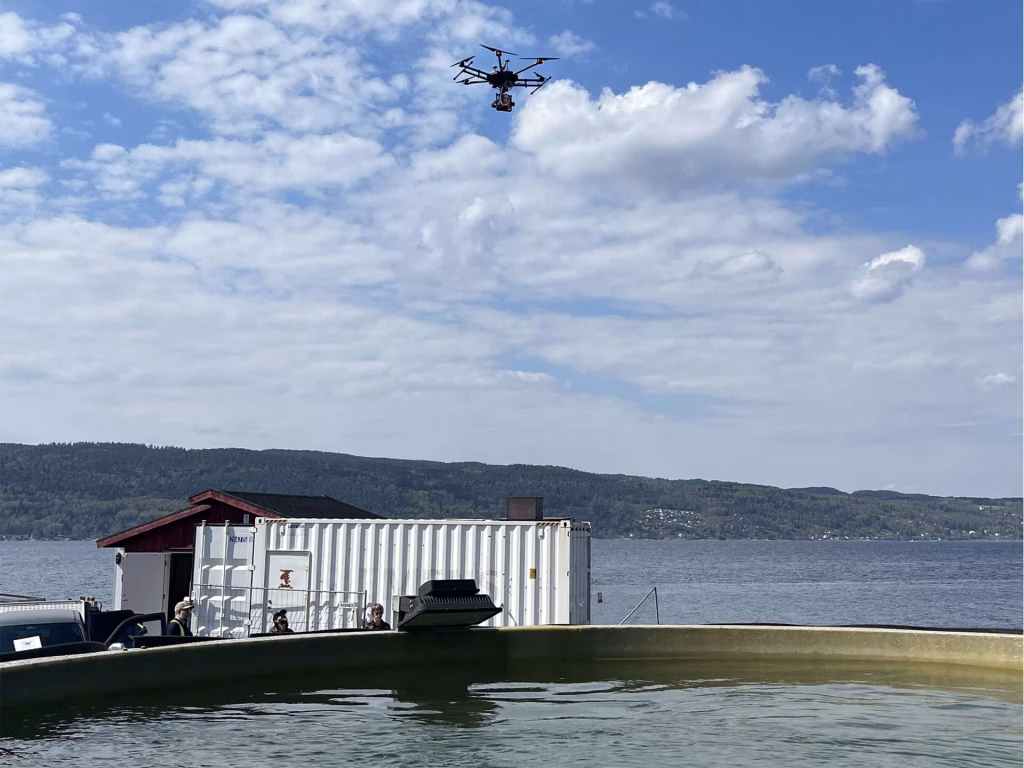
A DJI Matrice 600 Pro with Specim AFX10 multispectral camera flown over the tank at Solbergstrand. Photo: Sabine Marty, NIVA
Key results
In 2023, we evaluated the drone-based ocean colour methods at NIVA’s field research station Solbergstrand, using multispectral and hyperspectral cameras mounted on DJI Matrice 300 RTK and DJI Matrice 600 Pro drones, respectively. The drones flew over an outdoor tank filled with Oslo fjord seawater, which was manipulated to simulate various conditions, such as phytoplankton bloom, high concentrations of CDOM and increased turbidity. Water samples analysed with a spectrophotometer, and images were examined for correlations between reflectance measurements and discrete measurements of chlorophyll-a and turbidity. In addition to these controlled experiments, we also flew the drones over Oslo fjord and took in situ water samples for chlorophyll-a and turbidity.
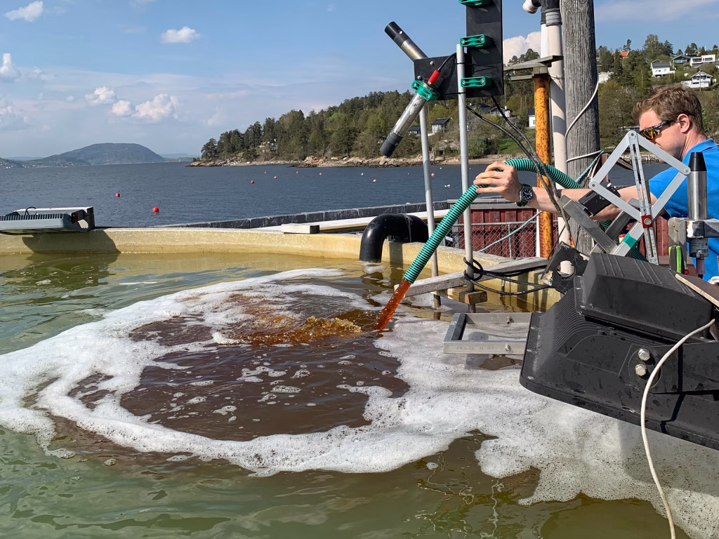
Addition of lingin to the outdoor tank at Solbergstrand. Photo: Sabine Marty, NIVA
The results showed that both the multispectral and hyperspectral sensors performed well for quantifying chlorophyll-a across the experimental range of 0.78-17.44 µg Chl a L-1. The hyperspectral camera data also exhibit chlorophyll-a absorption at 670 nm and sun-induced chlorophyll-a fluorescence at 760 nm. Both sensors also performed well for quantifying turbidity across the experimental range of 1.06-18.49 FNU. Turbidity is strongly correlated with total suspended material (TSM) concentration.

Remote sensing reflectance (475 nm/560 nm) plotted against chl-a concentration (mg m-3 = µg l-1) from the Altum PT multispectral camera (left) and from the Specim AFX10 hyperspectral camera (right) from test flights over the experimental tank and Oslo fjord coastal water. Image: Sabine Marty
Contact
Interested in learning more about our work on water quality or opportunities for collaboration? Please contact us:
Lead of water quality work in SeaBee: Sabine Marty (NIVA), NTNU (Joseph Garett)
SeaBee operations coordinator: Trygve Heide (NIVA)
Examples of our work
STORIES

PUBLICATIONS